Improving Remote Sensing Technology with Satellites Easier and More Reliable to Understand the Situation of Land and Disasters
Release:
Update:
NEW
NEEDS
Establishment of Technology to Understand the Condition and Changes of National Land through Image Analysis by Satellite
Since 2020, Nippon Koei has been working on the development of "remote sensing" technology to investigate objects. A major turning point was the joint research on "maintenance and management technology for embankments" with Japan Aerospace Exploration Agency (JAXA), which was conducted for three years starting FY2014.
Japan has a history of battle against flooding, as many people live in the sedimentary plains in Japan. In lands with low elevation, even a slight rise in the water level of a river can result in flooding. The national and local governments have taken measures against floods by building many strong levees.
Like all structures, levees deteriorate and settle naturally, requiring periodic maintenance. Until now, workers walk along the levees to check for defects, but remote sensing technology using satellites has made this inspection work possible.
The resolution of the photographs makes the use of satellites to map national land difficult. Accuracy has improved over the years, but at that time the resolving power was three meters per pixel. In the case of a small embankment, this level of accuracy makes it impossible to tell where the slope was and where the road was at the top edge. Incorporating innovations such as installing reflectors, Nippon Koei was able to establish this technology as a technique for screening large variations.
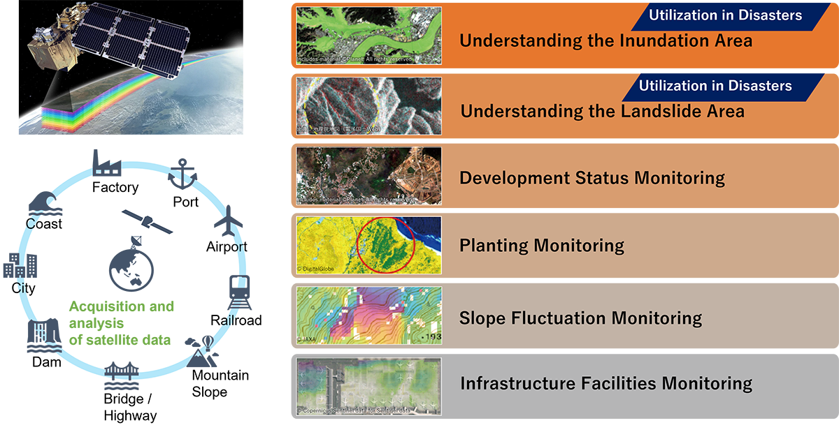
Even after the partnership with JAXA ended, Nippon Koei has continued to develop its own technology by combining remote sensing using satellites with accumulated knowledge. Currently, there are six major genres in which Nippon Koei is working to solve problems while receiving orders as part of its business. These are:
① flood inundation area monitoring.
② landslide collapse area monitoring.
③ urban development monitoring.
④ vegetation monitoring.
⑤ slope change monitoring.
⑥ infrastructure facility monitoring.
All of these technologies are useful in situations where the target area is large and workers cannot enter the site. Nippon Koei believes that the need for satellite-based remote sensing technology will continue to accelerate.
SOLUTION
Improve the Accuracy and Quality of Information to Achieve a More Accurate Picture of Actual Conditions
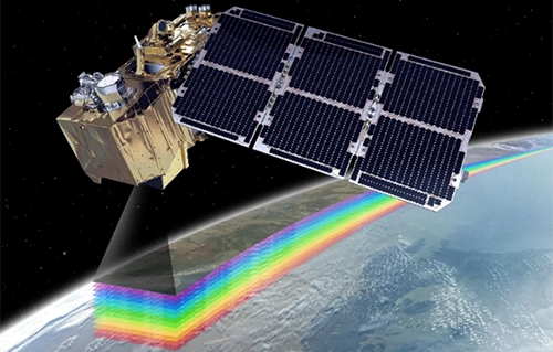
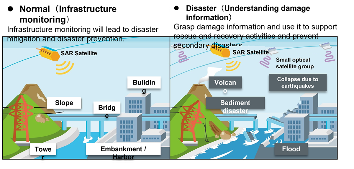
There are two main types of satellites that provide imagery. First is the optical satellite, which observes the sunlight reflected from objects. The advantage of this type of satellite is that it can observe the color, size, shape, etc. of an object due to its similar characteristics with an ordinary camera. However, it cannot transmit through clouds and photograph at night.
The second type is the synthetic aperture radar (SAR) satellite. By irradiating microwaves and measuring the phase difference of the reflected waves, the presence, material, structure, and changes in the object can be analyzed. The main advantage of this system is that it can operate in the presence or absence of clouds and at night. However, it cannot recognize colors and all objects with strong reflections will appear white.
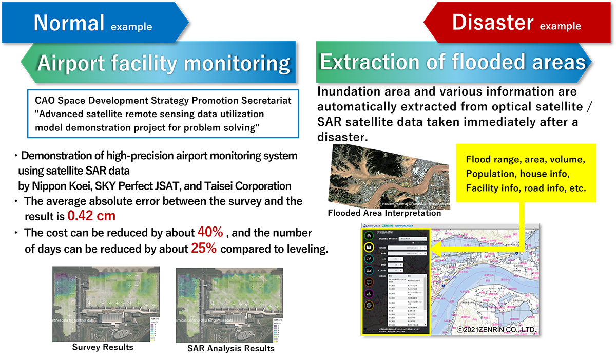
We have used the characteristics of these two types of satellites to improve our technology for understanding conditions and changes on the ground in detail. For example, the use of SAR satellites is effective for flood damage where people cannot enter the site and the only way to assess the current situation is with several helicopters. It is possible to determine the area that has been inundated and get more detailed pictures of the full extent of the flood damage.
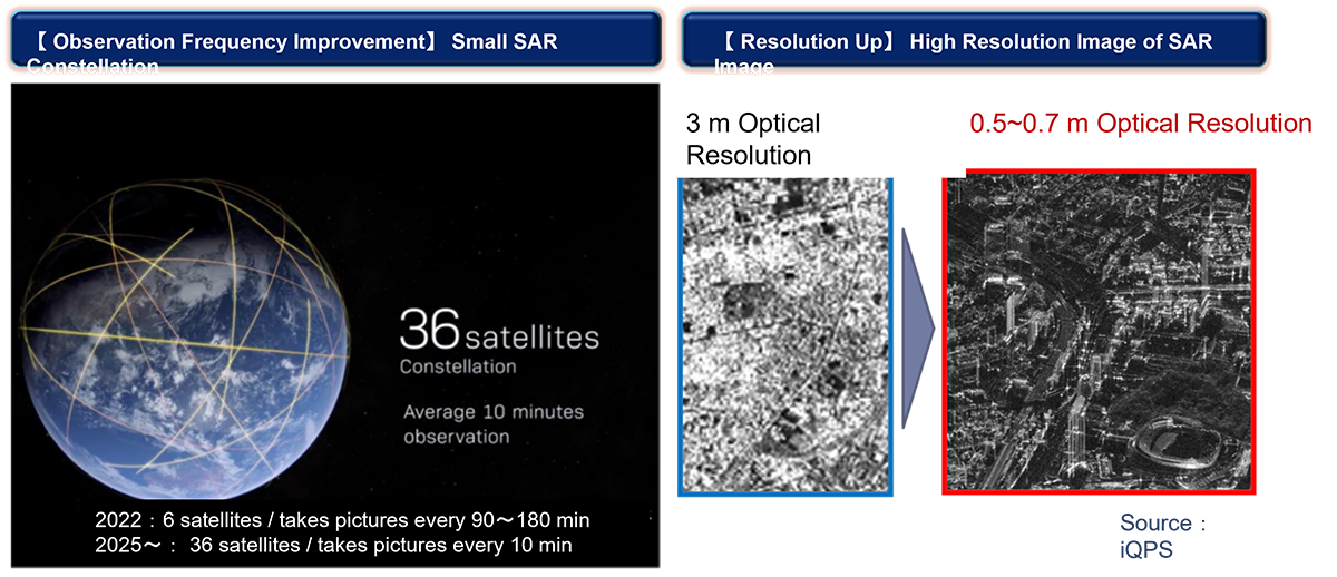
The current challenge is to increase the frequency of photography to acquire and analyze near real-time image data. Flooding in Japan occurs quickly from the time a levee breaks until the water level drops, and the situation changes from moment to moment. Currently, disaster response satellites can only take images at intervals of about one every six hours, reserved six hours in advance. This means that we had to make reservations about half a day in advance to anticipate disasters, and the timing of the shots was often not during the time of the levee breach.
As a countermeasure, Nippon Koei has partnered with QPS Research Institute, a Kyushu University venture that develops and launches small, lightweight, low-cost, and high-quality satellites. We are aiming to shorten the imaging interval. Currently, the lead time from reservation to imaging has been significantly shortened, making it possible to take an image once every hour. In the future, Nippon Koei is aiming to launch 36 satellites to achieve a system capable of taking images at a pitch of once every 10 minutes.
POINT
Making Japan's Space Age Dawn in a Smarter and More Useful Way for People
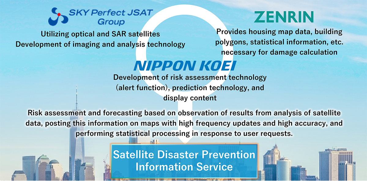
In order to further improve accuracy and quality, Nippon Koei's satellite information services have formed business alliances with the top runners in various fields. The partnership with SKY Perfect JSAT Corporation promotes the development of image capture and analysis technology utilizing optical and SAR satellites. Meanwhile, Zenrin Co., Ltd. provides the residential map data, building polygons, and statistical information necessary for damage calculation.
The alliance’s highly specialized engineers have completed the product in-house and released the space services. Actually, what is required for the space business to evolve at an accelerated pace is the speed from development to release. We are working on the next generation of manufacturing, which will realize quick and high-quality services by multiplying the technological capabilities that each company has carefully nurtured.
Future developments are expected to include the use of artificial intelligence (AI). For example, we are developing a service that uses AI to predict the risk of slope collapse in advance by combining basic information on slope topography, geological characteristics, disaster history, rainfall information, etc., with data from satellites on the micro-volcanic conditions. The product has already been commercialized before its release.
It is no longer in the realm of the imagination for people to expand their sphere of activity beyond Earth. The infrastructure-related business that we have cultivated to date is a good match with space venture companies, and further development is expected. Eventually, we will go to the Moon and Mars. There is no end to our dreams for the future. As a company that will pioneer the times, we will first refine our satellite information services to protect people's lives and livelihoods.